India is reportedly in discussions with international commercial satellite firms to acquire high-resolution imagery, a move aimed at significantly boosting its surveillance capabilities following recent geopolitical developments.
Boosting India’s Eye in the Sky
The Indian government is actively seeking advanced satellite imagery from global providers. This initiative comes as high-resolution surveillance proves increasingly vital in modern military situations and evolving battlefield scenarios.
Officials confirm the goal is to enhance India’s surveillance reach. This would allow for more efficient real-time monitoring, particularly crucial during conflicts, to support military operations effectively.
The “Operation Sindoor” Wake-Up Call
This push for enhanced satellite capabilities follows “Operation Sindoor” in May. During this period, it’s believed that China supplied Pakistan with live satellite inputs, offering critical intelligence on Indian troop movements.
Senior Army officials noted that during discussions, Pakistan cited “specific vectors” on the Indian side being prepared for action. This information was likely derived from satellite intelligence, underscoring a gap in India’s own surveillance network.
Why Commercial Satellites?
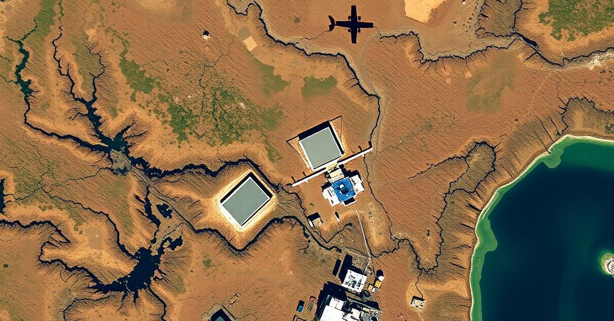
Tapping into commercial satellite imagery providers like Maxar Technologies could offer a significant advantage. Maxar, for instance, operates some of the world’s most sophisticated Earth observation satellites.
These satellites can capture images with a remarkable 30-centimeter resolution. Such detail is precise enough to identify critical targets, including infrastructure, buildings, artillery systems, and even individual vehicles.
While Maxar has not commented on ongoing negotiations, the potential access to such advanced imagery highlights the strategic importance of these talks.
India’s Current Satellite Landscape
India’s indigenous satellites, such as the Cartosat and RISAT series, have played a vital role in national defense. They aid in strategic planning, tracking enemy movements, and assessing strike impacts.
However, these domestic systems have certain limitations. For example, while Cartosat-3 was designed for 30-centimeter resolution, it typically provides good quality at about 50 centimeters. More critically, Cartosat-3 operates as a single unit.
This solitary operation restricts how frequently it can scan the same area. In fast-paced military engagements, where rapid updates on specific sectors are essential, this limited revisit time can be a significant constraint.
Looking Ahead: India’s Own Satellite Upgrade
Recognizing these gaps, India is also fast-tracking its own satellite capabilities. Under the Space Based Surveillance (SBS)-III program, 52 new surveillance satellites are being deployed, a decision accelerated after “Operation Sindoor.”
This ambitious program aims to provide enhanced monitoring of land and sea borders with improved imaging and all-weather functionalities. Satellite launches are expected to begin next year, with full deployment by 2029.
The Union Cabinet approved $3.2 billion for the SBS-III program last October. Under this plan, ISRO will build and launch the first 21 satellites, while private Indian companies will handle the remaining 31, marking a significant step towards self-reliance in space-based surveillance.
- India is seeking high-resolution satellite imagery from global commercial firms to enhance its surveillance.
- This move is prompted by insights gained from “Operation Sindoor,” where China reportedly provided real-time satellite intelligence to Pakistan.
- While India has its own satellites, they face limitations in resolution and frequency of coverage, particularly crucial in dynamic conflict zones.
- India is also independently developing its Space Based Surveillance (SBS)-III program to launch 52 new satellites by 2029, involving both ISRO and private companies.
These parallel efforts underscore India’s commitment to fortifying its defense capabilities through advanced space-based intelligence.